Shift in Hurricane Season’s Predicted Severity Highlights Need for Prospective Cat Risk Pricing
By Jeff Dunsavage, Senior Research Analyst, Triple-I (07/19/2023)
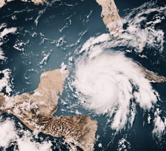
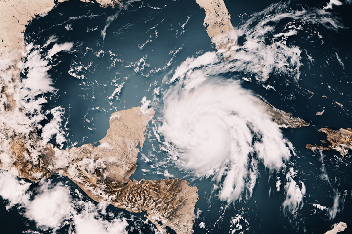
A shift from La Niña conditions in the central Pacific to El Niño was supposed to usher in some kind of reprieve from the past three above-average Atlantic hurricane seasons – but historically warm waters in the tropical Atlantic this year have tamped down that expectation.
During La Niña, the Atlantic hurricane season tends to be more active because the cooler Pacific waters promote development of high pressure that influences atmospheric conditions over the Atlantic, strengthening the trade winds that blow from east to west across the tropical Atlantic. La Niña also tends to reduce vertical wind shear, preventing developing storms from being torn apart and enabling them to intensify into hurricanes.
La Niña conditions have prevailed during the most recent three seasons, contributing to above-average hurricane activity, including Hurricane Ian in 2022, a Category 4 hurricane that killed more than 100 people and caused estimated losses between $50 billion and $65 billion, according to Swiss Re Institute.
In a typical season, the shift to El Niño conditions would be expected to lead to less hurricane activivity. But coinciding with this shift are historically warm waters in the tropical Atlantic that Brian McNoldy, a tropical weather researcher at the University of Miami, described as “beyond extraordinary”.
These warming conditions are part of a global pattern that is now outpacing anything seen in four decades of satellite observations, according to Dr. Phil Klotzbach – a research scientist in the Department of Atmospheric Science at Colorado State University and Triple-I non-resident scholar.
Such variability – demonstrated by wildfires and weather events other than hurricanes – underscores the importance for insurers of using the most current data and best modeling technologies available to inform underwriting and pricing of climate-related risks. As reported in Triple-I’s most recent Issues Brief, the property/casualty insurance industry is responding with an increased focus on predicting and preventing damage and losses.
Integral to this evolution are technologies and methods that help insurers and policyholders get out in front of perils.
The early detection of the storm system that became Tropical Storm Bret is a prime example. In what Dr. Klotzbach called an “impressive long-range predictive signal,” the European Centre for Medium-Range Weather Forecasts was highlighting the area in which the system was identified for potential development nearly a month before it began to form.
“As computer models have become more sophisticated, they have gotten better at long-range prediction of the large-scale atmospheric and oceanic conditions that favor or disfavor hurricane activity,” Klotzbach said.
Learn More:
CSU Updates Atlantic Hurricane Season Forecast to “Above Average”
Predictive Model Anticipated Tropical Storm Bret’s Early Appearance
Likely Shift to El Niño Expected to Make 2023 Atlantic Hurricane Season “Slightly” Below Average